SH 92 Roger Mesa Access Control Plan and Conceptual Design
About This Project
Background
- Safety improvements on SH 92 through Rogers Mesa identified as one of the top priorities for the Gunnison Valley Transportation Planning Region (TPR)
- Delta County and Colorado Department of Transportation (CDOT) recognized a lack of controlled access to and from SH 92 through Rogers Mesa that contributed to safety issues through the segment
- Over 150 access points within approximately 5 miles of highway
Challenge
- Public perception of access consolidation is often negative and requires a high level of engagement and education
- Access planning and design projects have not historically been combined
- Lack of circulation in the regional area results in a high level of dependence on SH 92 for mobility and access
- Complex existing irrigation systems create design challenges for widening the roadway section
Solution
- Stolfus & Associates deliberately tied the access planning process and design process together to provide both an interim and long-term vision for the corridor
- Managed a public involvement program to engage property owners, businesses, residents, utility and irrigation companies, emergency services and the general public
- Held 2 Open Houses with over 80 attendees at the first and nearly 60 attendees at the second
- Conducted 45 one-on-one property owner meetings
- Presented at 3 public meetings with the Delta County Board of County Commissioners
- Utilized online public involvement tool and Survey Monkey to gather feedback
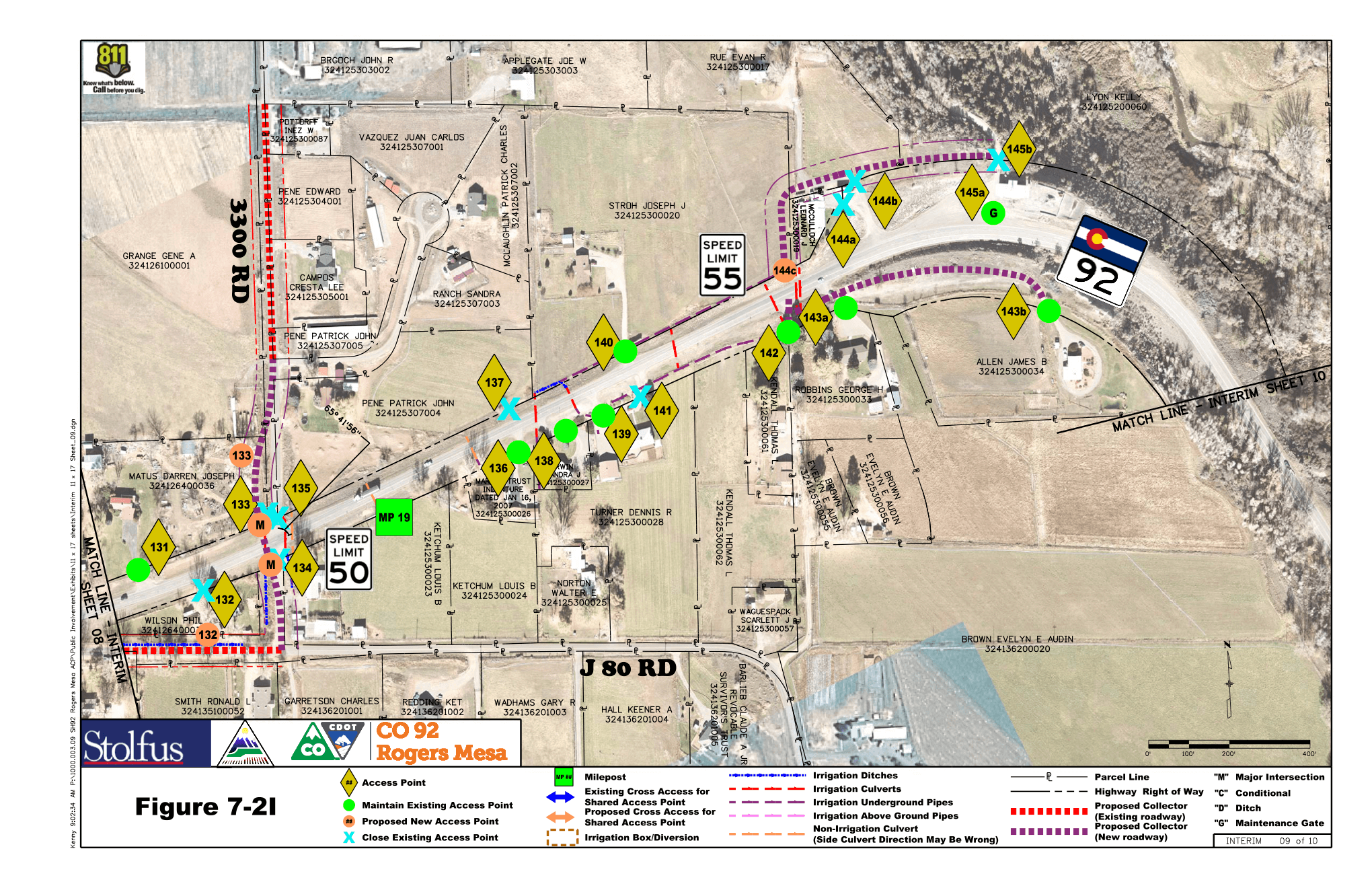
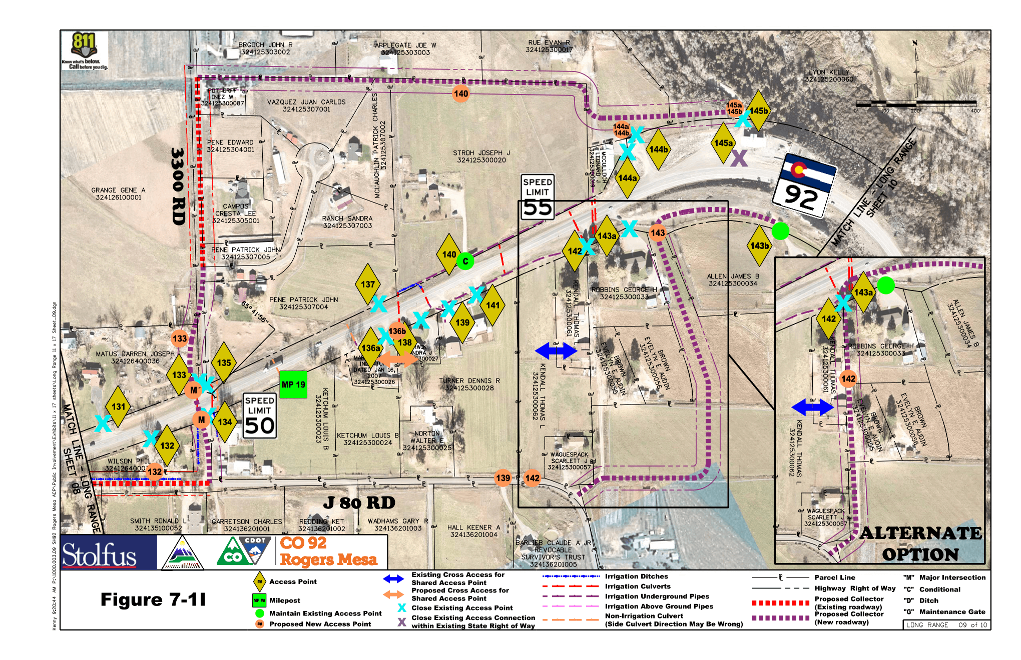
- Developed a long-range access control plan and county road plan to address access and circulation as land-use changes (reduces number of access points from 153 to 75)
- Developed an interim access plan compatible with current land-uses to be implemented with a CDOT project (reduces number of access points from 153 to 114)
Outcome
- Successful adoption of a long-range Access Control Plan through a signed Intergovernmental Agreement (IGA) between Delta County and CDOT that provides both agencies and property owners with a long-term vision of the corridor
- A publicly-vetted interim access plan provides CDOT with specific direction on access consolidation with their planned construction project